The Agrocenter platform in Agricultural Production
For the Rural
Producer
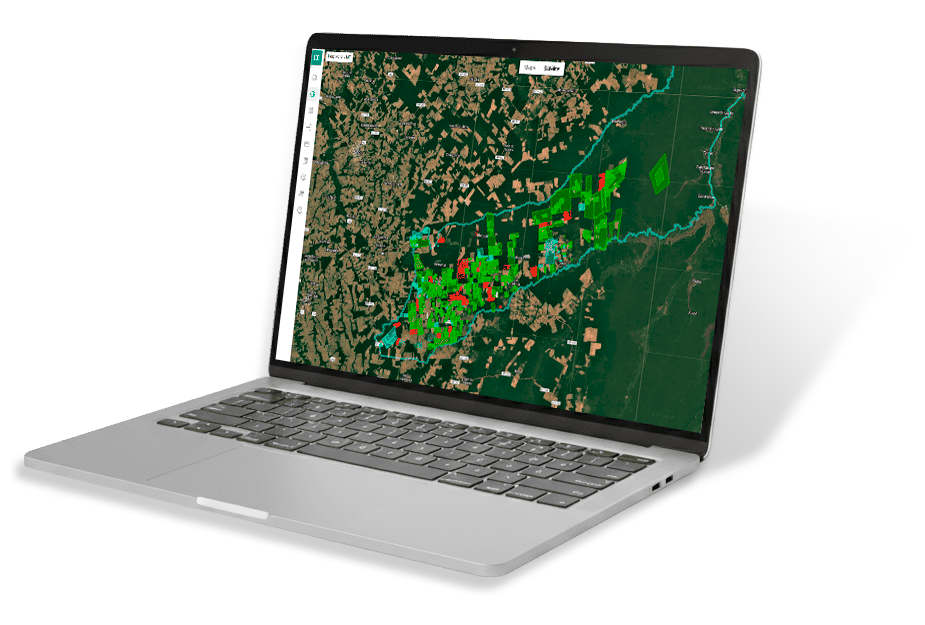
Real-time Rural
Property View
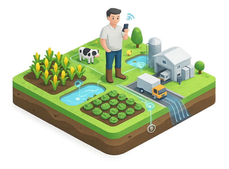
Makes everyday life easier in the field with practical and organized records
The producer records crop information, pests and diseases, requests and other activities in real time, while the agroindustry receives standardized and reliable data.
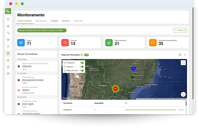
Centralizes all crop information in one place
Satellite images, weather, soil analysis and field records are organized, reducing rework and repeated requests for information.
Streamlines technical support and decision making
With updated data, the producer receives faster and more precise guidance, avoiding losses and delays in management.
Ensures transparency and compliance in the use of productive areas
The history of land use is recorded and traceable, supporting audits, quality programs and compliance requirements.
For the Agroindustry
Strategic Vision
and Integrated
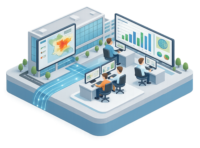
Have a consolidated and standardized view of all productive areas
Follow crops, plots and phytosanitary risks in real time, with reliable and traceable data.
Reduce operational and environmental risks with active governance
Identify occurrences, sensitive areas and socio-environmental liabilities before they impact the business.
Meets traceability, compliance and ESG requirements
Centralize documents, evidence and indicators in automatic and auditable reports.
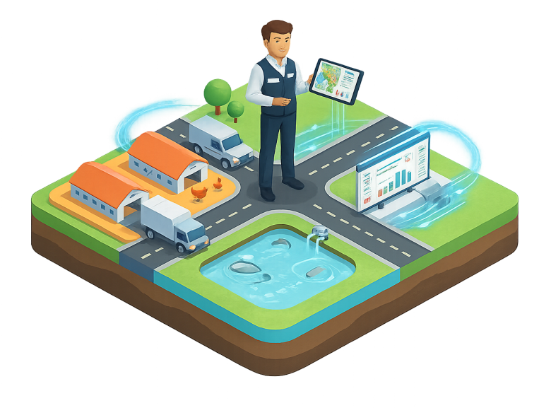
For the Technical Consultant
Technical Analysis
Data Oriented
Improve the relationship with the producer
Share structured checklists, tasks and messages to ensure clear and efficient collaboration.
Plan routes and visits intelligently
Use a tablet to view and optimize shift schedules across multiple properties.
Automate visit reports
Generate instant reports with KPIs and recommendations once you complete the property visit.
The future of agricultural management starts now!
More than control, intelligent, sustainable and profitable governance.
- Integrated production management, from field to office
- Centralizes properties, documents and socio-environmental compliances
- Real-time monitoring of climate data and crop health
- Unified view of the occurrences of the crops
- More efficiency, traceability and profitability in each crop

Integrated and sustainable production management
Transform the harvesting of the crop into a real competitive advantage.
With AgroCenter Agrícola, you map properties, monitor pests, diseases and soil nutrients.
Track the health of crops by satellite images, anticipate climate risks, identify the best planting windows and optimize the use of inputs to ensure more precise decisions.
More control, efficiency and profitability at each stage of agricultural production!
Technology that drives growth
Quick and easy registration of field activities
Simplify the day to day by recording all activities in an agile, practical and intuitive way. Centralize information, reduce errors, ensure traceability and facilitate communication between teams for faster and more accurate decisions.
Efficient planning and real-time occurrences
Plan crops, anticipate demands and monitor the progress of operations with information updated on the spot. Identify deviations, record occurrences immediately and ensure greater control, predictability and agility in responses to property needs
Enhance results with precision agriculture
Leverage data from weather stations, satellite maps and intelligent analytics to understand each area of the crop, adjust inputs and optimize applications. Reduce costs, increase efficiency and boost productive performance with decisions based on reliable and up-to-date data.
More productivity, less waste and control of operations.
Track each step in the production chain, optimize resources and reduce losses with clear insights into performance and costs. Strengthen management, standardize processes and maximize results with a more organized, efficient and transparent operation.
More than control: it is intelligent rural governance.
Security, transparency and sustainability to generate lasting value.
Its safer, traceable and future-prepared agricultural operation.
- Identifies socio-environmental risks with intelligence and continuous monitoring.
- Detects sensitive areas and overlays with preservation zones.
- Prevents impacts and reduces the chance of future damage.
- Validates geospatial data and optimizes the management of the generated information.
- Simplifies records, monitors indicators and supports activity planning.
Greater productivity and clarity in every decision